Road Trips and Tiny Trailers
All you need for planning the best road trips in your tiny trailer!
7 PARKS * 9 DAYS: SEEING THE NATIONAL PARKS OF THE SW
Seeing the National Parks of America’s SW will expose you to canyons, rock formations and beauty you’ll not see anywhere else in the world!
It was springtime in the Rockies, and COVID-19 had my husband, Eddie, and I wondering just where we could go for this year’s vacation. It turned out that we had purchased a National Parks Pass the prior year and had about 3 months left until the expiration date. That made our decision easy. We started looking at the National Parks of the SW, which sadly were almost in our backyard, and yet we hadn’t seen them! So, we put a highlighter to a map and discovered that we could see 7 of those parks in less than 10 days. It would be a bit of a marathon, but we selected our dates, packed up our little teardrop trailer, and off we went! We chose to visit in April, and although we got some rain, the crowds were very light. Our National Parks itinerary looked like this:
Petrified Forest * Grand Canyon * Zion * Bryce * Capitol Reef * Arches * Canyonlands
*A National Parks pass is good for 1 year and is much less expensive than paying the entrance fee at each park. Get a pass and info HERE.*
***********************************************************************
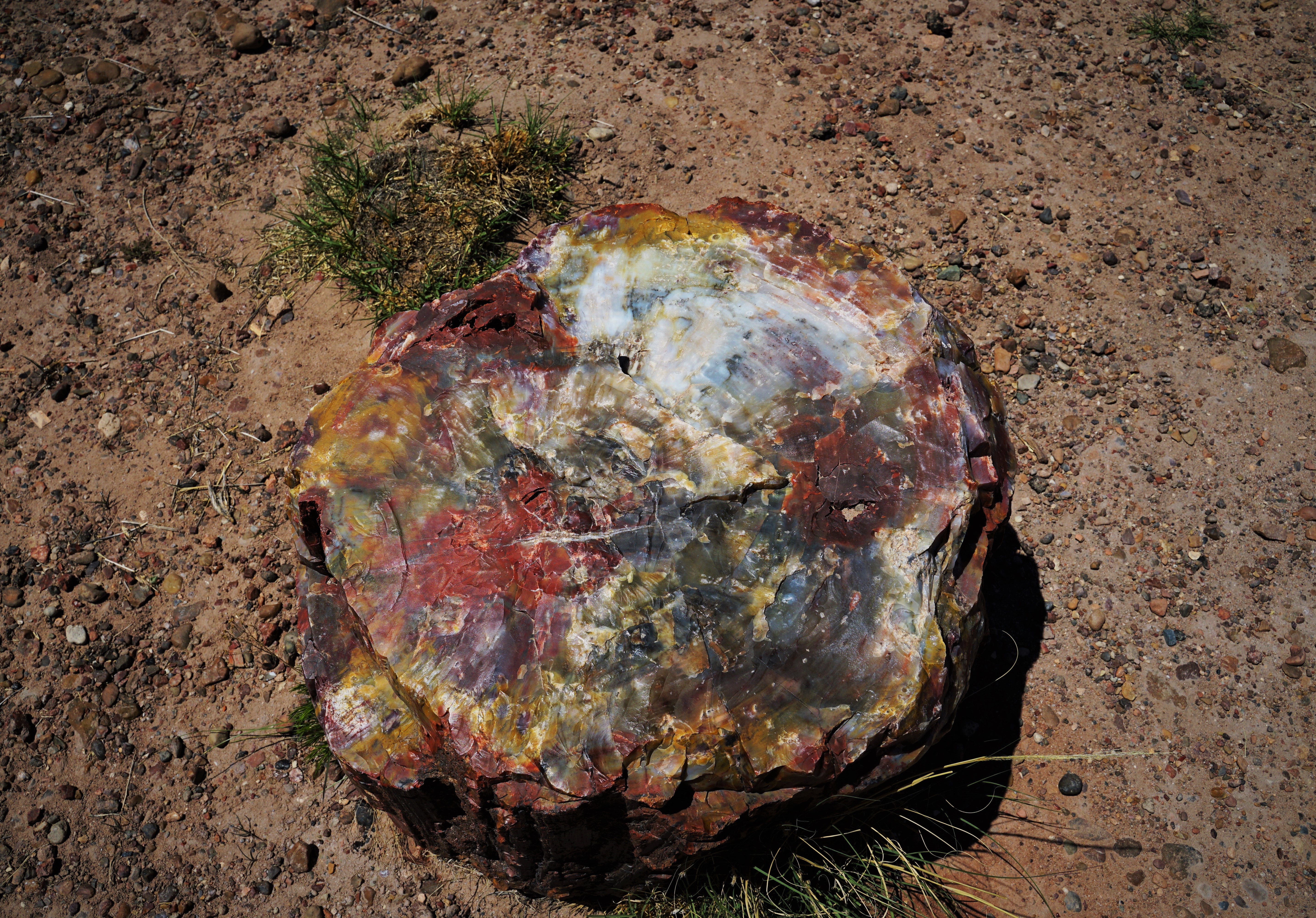
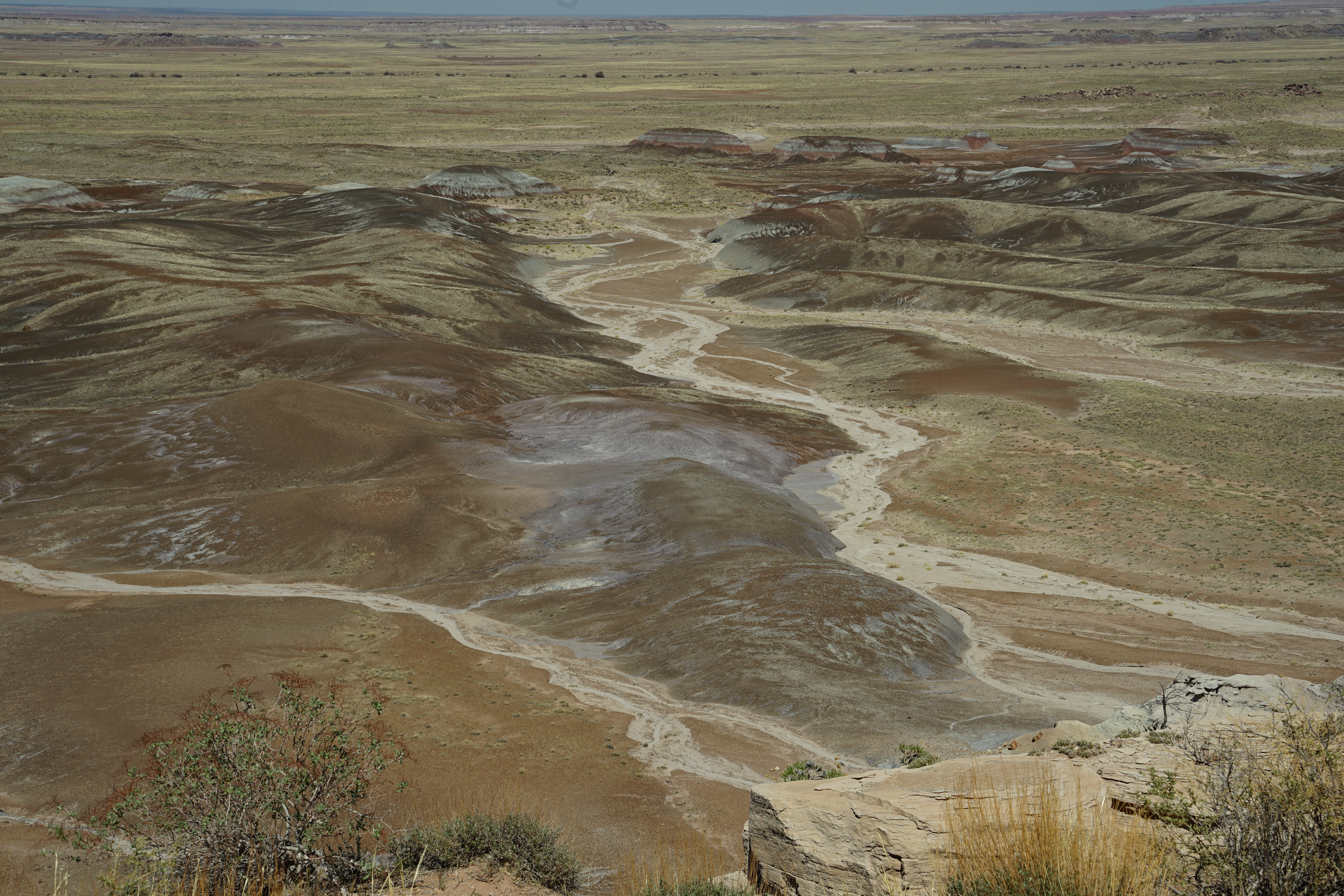
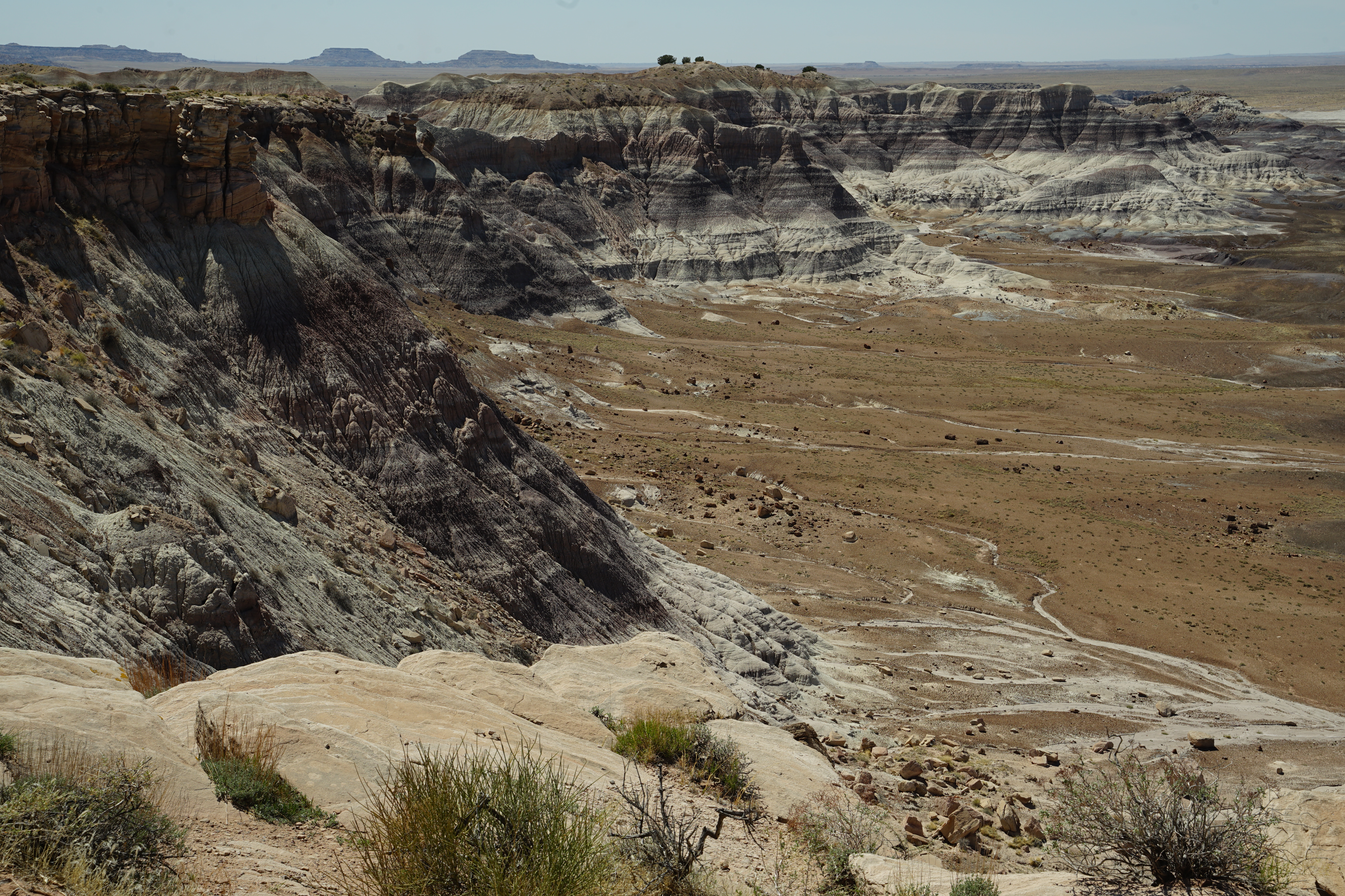
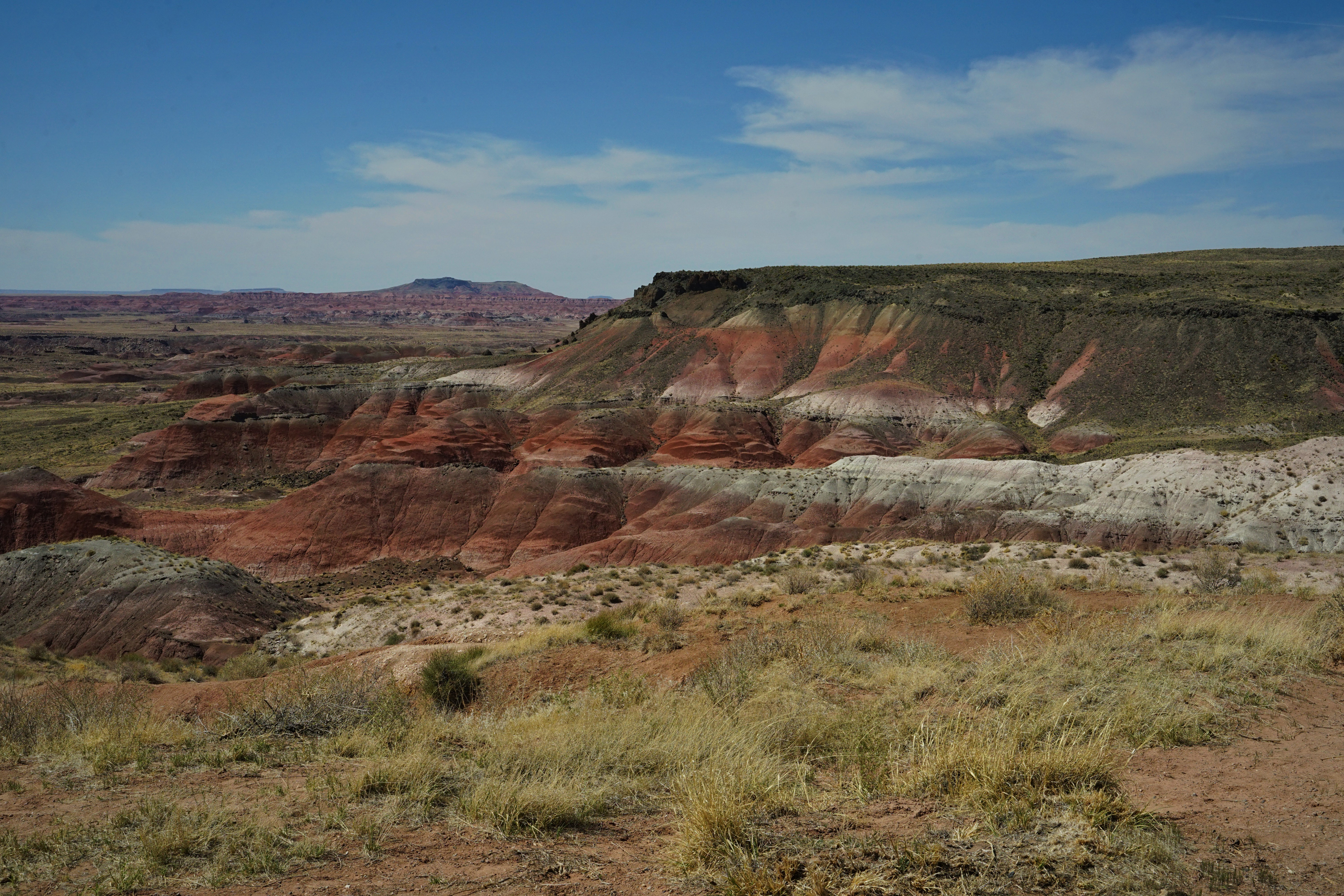
Stop #1: The Petrified Forest National Park AZ
The Petrified Forest was designated a National Monument by Theodore Roosevelt in 1906. It became a National Park in 1962.
It’s located about 3.5 hrs NE of Phoenix just outside of Holbrook.
The easiest way to see the park is to pull up a map and look at all the stops. Stop at the ones that look the most interesting. There is about 1.5 hrs of drive time from the south entrance (start there at the Visitor’s Center) to the Painted Desert Rim on the north edge. If you take time at every stop (10 min average) that will add around 2-3 hrs. There are also a few hikes, so this park can easily take up a full day. We enjoyed the park, did 8 of the stops, and were there for about 4.5 hrs. I loved this Park. Perhaps it’s a ‘one-and-done’, but it is sure worth it once! I was fascinated by the beautiful colors the minerals created as the logs petrified. And yes, my new kitchen is now done in that color scheme.


INTERESTING INFO:
*Annual visitation to the Park is about 800,000.
*The Park has over 221,000 acres, 50,000 of which are designated Wilderness.
*The Puerco Pueblo, built by the ancestral Puebloan people, was occupied between A.D. 1200 and 1400.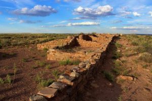
*The main enviornment of the Park is semi-arid steppe & grassland (‘steppe’ means ‘a large area of flat unforested grassland’).
*There are hundreds of species of plants & animals in the park including: pronghorn, Gunnison’s prairie dog, coyote, bobcat, bullsnake, Arizona tiger salamander, meadowlark & golden eagle.
*The Agate House was built out of petrified wood & was occupied between A.D. 1100 – 1500
*Covering 10,000 yrs of human history, there are over 800 archeological and historic sites.
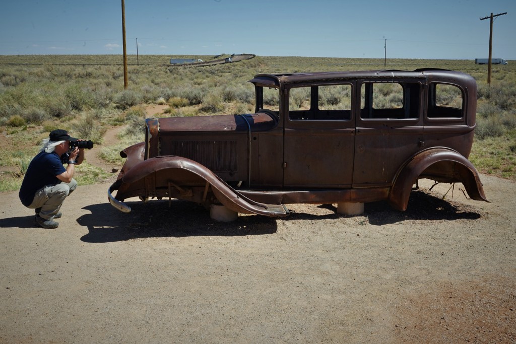
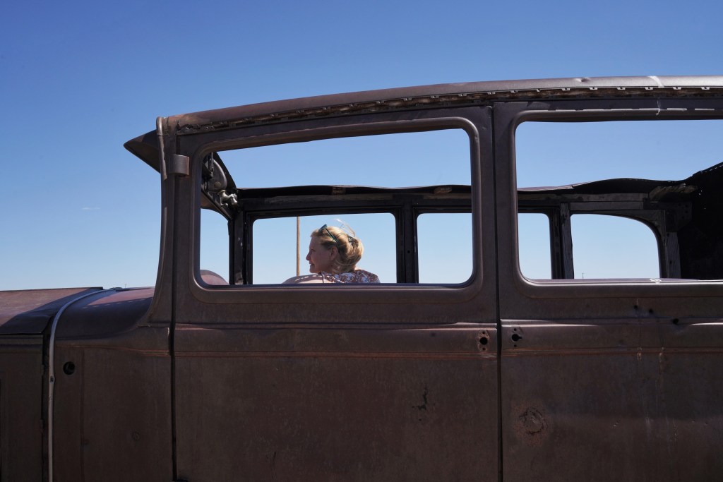
*This is the only national park that contains sections of both the Historic Route 66 and National Old Trails Hwys. Here you can see a Studebaker along old Route 66!

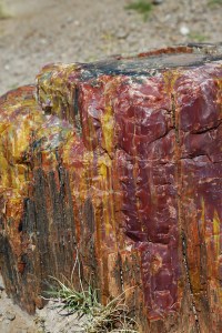
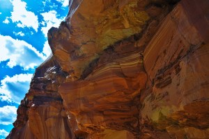
*The colors in the petrified logs come mainly from 3 minerals. Quartz is white; Iron oxides go from yellows to reds to browns; and Manganese oxides are black, purple, pink & blue; and Copper, Cobalt, and Chromium give off a green-blue color.
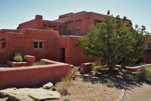
*The Painted Desert Inn was built in 1924, reconstructed in the late 1930s, and rehabilitated by 2006. It is now a National historic Landmark.
GOOD TO KNOW BEFORE YOU GO:
*We stayed at the Holbrook KOA. Not many trees in the desert, but the bathrooms were clean, and the place met our needs. I give it a 7 out of 10. Check out their website HERE.
*Definitely start at the Crystal Forest Museum at the South End, and don’t miss the Rainbow Forest Museum at the Visitor’s center. There’s a lot to learn, and you can’t see too many rocks..right?
*Don’t miss Newspaper Rock…it’s easy to do. It’s located just south of the Puerco Pueblo, and it has petroglyphs carved on it. See if you can figure out the local news in A.D. 1300…
*The Blue Mesa rock formation really isn’t blue. It is, however worth a picture (add the blue with a little photoshop).
*For info and a park map to plan your visit, click HERE.
***********************************************************************
Stop #2: The Grand Canyon National Park AZ
The Grand Canyon was designated a Game Reserve by Theodore Roosevelt in 1906. Two years later it became a National Monument, and finally a National Park in 1919.
The Grand Canyon is located in Arizona, and it’s South Rim Visitor’s Center is 60 miles north of Williams, AZ.
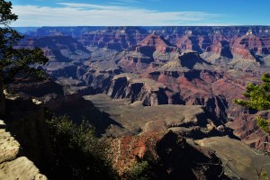
As far as big craters in the planet go, this one’s a doozey! If you’ve never been here, the South Rim will give you the most to see and do. Save the North Rim for a trip back. If you are into hiking, there are 125 trails to choose from at the Grand Canyon, but only 12 trailheads are located at the North Rim. There is the Skywalk at the North Rim, though, if heights don’t getcha….
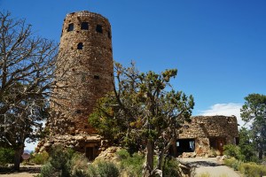
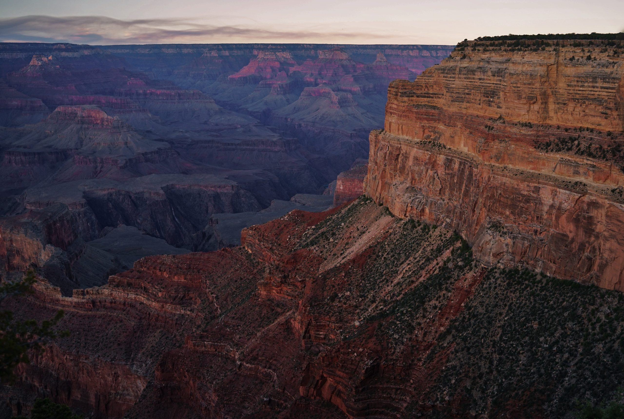
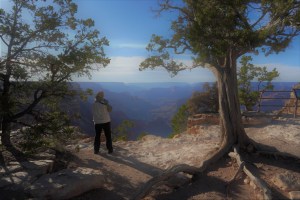
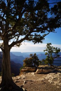
We drove from the Grand Canyon Village to the canyon’s furthest southeast edge at the Desert Watchtower. We stopped at each scenic spot until we got back to the Village. With an average of 7 minutes at each stop, we spent under 2 hours to see all 7 scenic views (east of the village) accessible by vehicle.

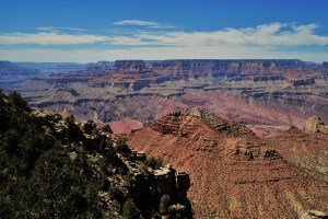

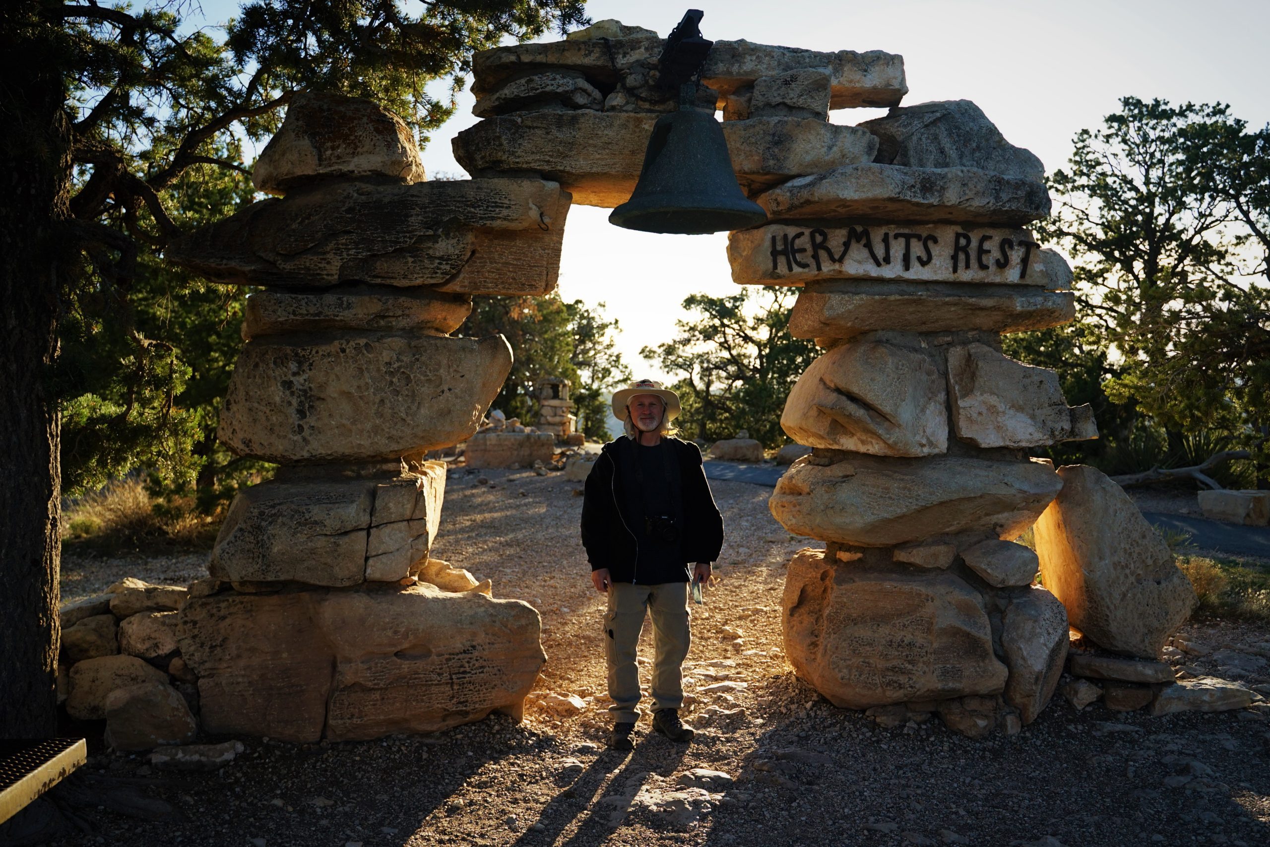
To see the west section of the canyon, we then purchased our transfer tickets at the Bright Angel Lodge, and walked up to the bus stop. There are no cars allowed on Hermit Road (at least in April when we were there), and this hop-on-hop-off bus was the perfect solution. Be sure to pay attention to the bus schedule, or you might get left hoofin’ it back to the village. (If hiking is your thing, the trail from the end point at Hermit’s Rest back to the village, is just under 8 miles and will only take you about 3 hours or so). I had done some homework, and read that the best spots for sunset photos were at Mohave Point and Powell Point. I planned it so that we could be in those locations at sunset.

 INTERESTING INFO:
 INTERESTING INFO:
*The Grand Canyon is so big, that it can actually create it’s own weather!
*An average of 5.9 million people visit the Canyon each year.
*There are an estimated 1000 caves, but only 335 have been explored.
*The most dangerous animal at the Canyon is the Rock Squirrel. Its mostly because they bite dozens of visitors each year who try and feed them. Don’t be that guy.
*The Grand Canyon is 692 square miles larger than the state of Rhode Island.
GOOD TO KNOW BEFORE YOU GO:
*From helicopter rides and hummer or safari tours, to trips to the bottom for kayaking the Colorado River, there’s so much to see and do here. Check out tours that combine the Grand Canyon with some time at Hoover Dam as well. Just make sure to watch your pocketbook…you really can see pretty much everything from the rim.
*We stayed at the Williams KOA. The bathrooms were clean and really ‘interesting’. It’s about an hour’s drive to the Grand Canyon. I give it an 8 out of 10. Check out their website HERE.
*The town of Williams is worth some time spent. It was on the Old Route 66, and has many historic spots and shops to see, as well as some great restaurants.
*We packed a picnic lunch for our time at the park. There are not many places to eat at the South Rim (and even less on the North Rim) and those are pretty pricey.
*Don’t try and do both the South Rim & North Rim on the same day. They are about 5 hrs driving distance apart.
*For info and a park map to plan your visit, click HERE.
***********************************************************************
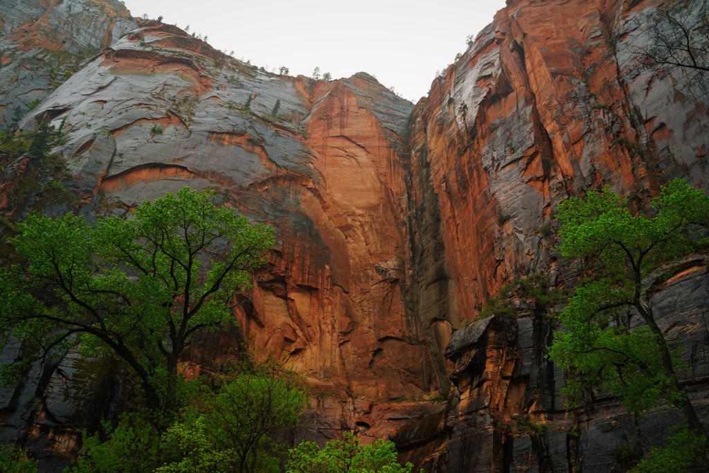
Stop #3: Zion National Park UT
President William Howard Taft created the Mukuntuweap National Monument in 1909, which became Zion National Park in 1919 when President Woodrow Wilson signed the bill into law.
Zion is located in the SW corner of UT. The Visitor’s center is just a 20 minute drive north of Springdale.
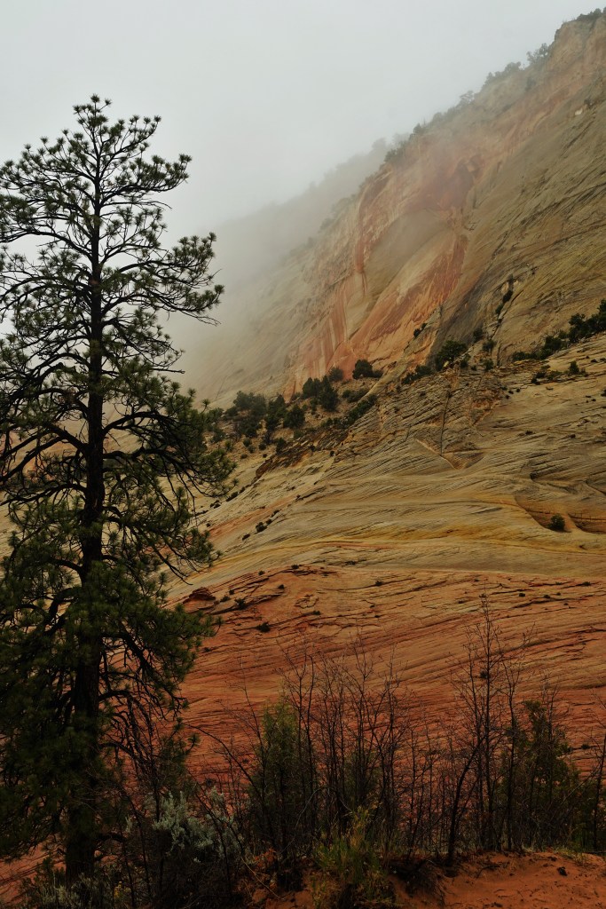
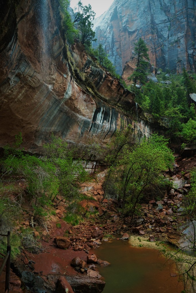
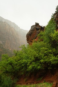
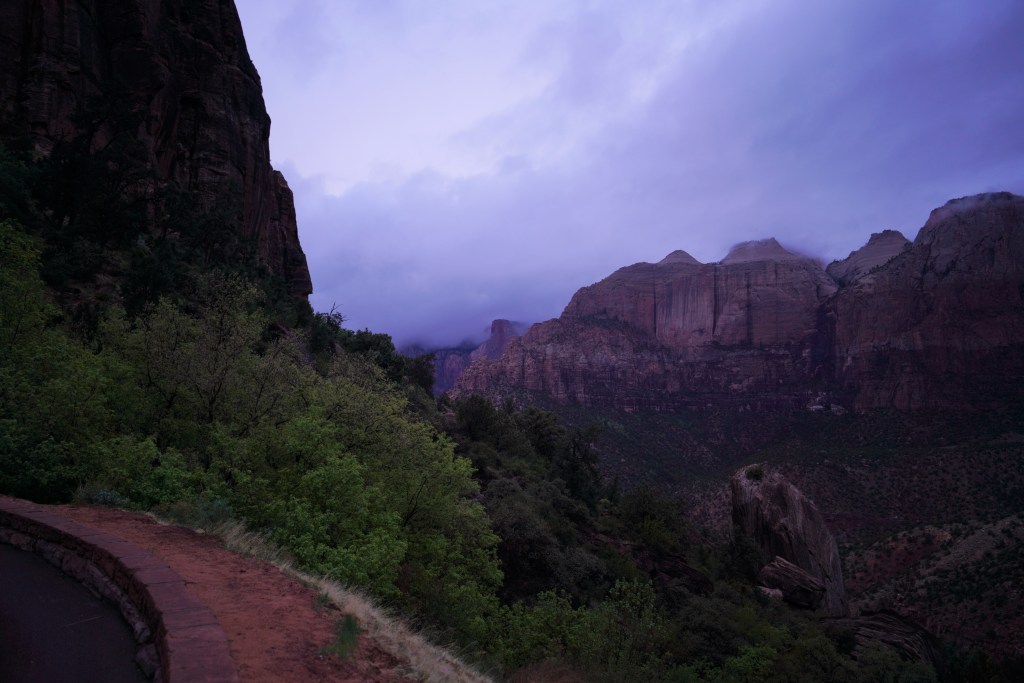
Zion was, hands down, our favorite National Park of the SW. It definitely had the ‘wow’ factor as we drove in from the east entrance. As we drove along Hwy 9 into the park, we entered a whole different world! A wet and rainy assortment of spiraled mesas glistening in the mist, greeted us as we drove through the Mt. Carmel tunnel. The view from the west side of the tunnel was completely different. What we saw there were pine trees nestled in a mountain landscape with sheer rock faces soaring into the haze. What a reception all that rain and fog gave us as we made our way to the campground to get set up!
After a quick set up, we boarded the shuttle for our hike to The Narrows and back as well as the hike to see the Lower Emerald pools. It poured rain the whole time we hiked, but the colors and the views were more than worth it. No matter what the weather, any time spent in Zion National Park is time you’ll treasure.


INTERESTING INFO:
 *The Zion-Mt. Carmel Highway and Tunnel is not to be missed. The 1.1-mile-long tunnel cuts through the vertical sandstone cliffs of Zion, and includes windows
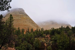 to provide views of Zion Canyon. It was completed in 1930, and repaired in 2019.
*The Anasazi were the original inhabitants of Zion Canyon, a civilization that thrived around 1,500 B.C.. You can see the remains of their sandstone villages, and rock art throughout the park today.
*Zion Canyon is constantly being reformed by the Virgin River. Each year, the river removes an average of 1 ton of sediment, deepening the river and widening the canyon.
*Zion is the 4th most busy National Park with an average of 4.3 million visitors each year.
*The California Condor is the largest flying bird in North America and can be found in the wild in Zion National Park. They have a wingspan of 10 feet from tip to tip, can fly as fast as 55 mph at heights of 15,000 feet. They are also endangered.
*Zion’s canyon is approximately 2,000 ft deep.
*Zion has a subway. Not for vehicles, but rather a strenuous 9 mile round-trip hike through the left fork of North Creek. This challenging route requires orientation skills, creek crossing, swimming and scrambling over boulders. You must get a permit for this hike, which is subject to daily limits.
*Angels Landing in Zion has been labeled as one of the scariest hikes in America. It’s a 2.2 mile hike, and the landing stands at 1,488 feet above the Virgin River. You’ll hike many zig zag trails up steep hills, sheer drops and exposed edges. However, if you come prepared and take it carefully, you’ll be rewarded with spectacular 360-degree views 1,500 feet above the canyon floor.


GOOD TO KNOW BEFORE YOU GO:
*During most of the year, most of the park is serviced by a free hop-on-hop-off shuttle bus. The Zion Canyon Line, or park shuttle, runs from the visitor center up the Zion Canyon Scenic Drive.
*We stayed at the Zion Canyon RV Park. It’s just outside the south entrance to the park. It’s in a great location, the showers are clean, and we enjoyed it very much! I give it a 9 out of 10. Check out their website HERE.
*Be prepared for a wait at the Mt. Carmel tunnel. Length restrictions are 40 feet for a single vehicle and 50 feet for any vehicle combination. Any vehicle that is 11′ 4″ or higher and 7′ 10″ wide or wider needs the one-way traffic control service which will cost you $15. Any vehicle 13′ 1′ inch high or higher cannot pass through the tunnel.
 *If you encounter a fair amount of rain, watch out for centipedes. They won’t chase you, but they can leave you with a nasty bite. And….yeah. They’re just gross.
*For info and a park map to plan your visit, click HERE.
***********************************************************************
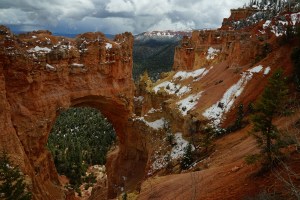
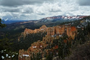
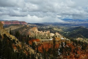
Stop #4: Bryce Canyon National Park UT
Bryce Canyon National Monument was originally established on June 8, 1923 to preserve the “unusual scenic beauty, scientific interest, and importance.” On June 7, 1924, the monument’s name was changed to Utah National Park and it was transferred to the National Park Service. On February 25, 1928 Utah National Park was changed to Bryce Canyon National Park.
Bryce Canyon National Park is located in the SW corner of Utah near the town of Tropic. It’s only a 1.5 hr drive from Zion National Park.
What a day to spend in Bryce Canyon National Park! As we made our way to our campground, we drove from snow into blue skies.
 Bryce took my breath away.
And it’s very easy to do in a day (unless your really into long hikes). The best place to start after entering the park is the Visitor’s Center. There are displays with lots of interesting information. From there, head towards the Sunset Campground, pull in and park. From here you can see Sunset Point and Inspiration Point just by walking the Rim Trail for a few yards. This is probably the best place to see the most of what Bryce has to offer.
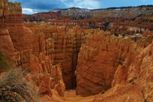
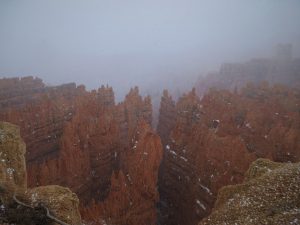
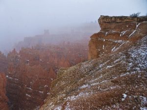
From this point there are also number of great hikes. We opted to head down the Wall Street Trail just to get a feel for being down among the giant sculptures (called ‘hoodoos’). From here we drove down to see the Natural Bridge. Its only about a 20 min drive, but there are a few stops along the way. Natural Bridge is definitely worth a look! By starting our time at Bryce in the sunshine, we got to see the hoodoos lit up by the sun. But by the time we got back to the visitor’s center it was snowing heavily and pelting us with hail. Stopping back in at Sunset Point for a few photos, gave us views of the hoodoos in the snow. We absolutley loved this park and we’re coming back to do some more hiking!


INTERESTING INFO:
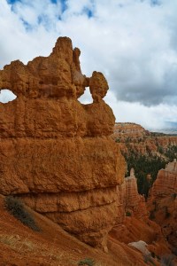 *Although Bryce is called a canyon, it’s actually groups of rock formations called amphitheaters.
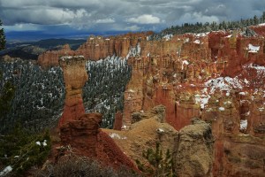
*The rock formations here are called Hoodoos. Hoodoos are sandstone located in hot, dry areas. They are formed by wind, rain, ice and gravity from sedimentary and volcanic rock. Groups of Hoodoos make up the amphitheaters.
*Bryce Canyon N.P. has the largest collection of Hoodoos in the world.
*Native Americans believed that the hoodoos were actually people called ‘Legend People’ that had been turned into stone by Coyote – a god that liked to play tricks.
*It is possible to see 7500 stars from Bryce Canyon on a clear night. This is more than double the visable stars in most other places in the U.S.
*About 1.5 million people visit Bryce Canyon each year.
GOOD TO KNOW BEFORE YOU GO:
 *We stayed at the Bryce Valley KOA. It’s a bit of a walk to the restrooms & showers, but its clean. I give it a 7 out of 10. Check out their website HERE.
*Check out The Pizza Place in Tropic and try some local beer. They have FANTASTIC Pizza!!
*Bryce is easy to see in a day, so plan a picnic lunch and then dive down into the Hoodoos on one of many trails in the park.
*At the North Campground General Store near the entrance, you’ll find showers if you need them.
*Get up early and be at Sunrise Point (located near the Lodge Gift Shop) for morning photos & views. There’s a reason its called Sunrise Point!
*Keep an eye out for the Astronomy & Geology festivals.
*Don’t be afraid of weather. It changes quickly. Get out and enjoy!
*For info and a park map to plan your visit, click HERE.
***********************************************************************
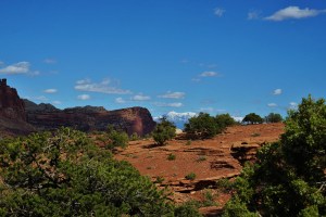
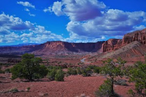
Stop #5: Capitol Reef National Park, UT
Capitol Reef National Park was designated a National Monument on August 2, 1937, by President Franklin D. Roosevelt to protect the area’s colorful canyons, ridges, buttes, and monoliths. But it was not until 1950 that the area officially opened to the public. A bill was introduced 1970 to make the Monument a National Park. That bill was signed into law by President Richard Nixon on December 18, 1971.
Capitol Reef is located in south central Utah near the town of Torrey.


 Capitol Reef is an easy park to do in a day. Don’t be misled, though. There’s plenty to see, do and learn here at this beautiful little park. We got into Torrey at about noon and got our camp set up. After lunch we headed into the park. We started with a very quick visit to the mini Visitor’s Center. Our first stop was the Fruita Schoolhouse, but it turned out to be more of a drive-by than a stop. We saw what there was to see by just rolling past and snapping a photo from the car window.
From there it was onto the petroglyphs. Evidently, these stick figures were carved by the Freemont people over 1,000 yrs ago. Ok. So far a little underwhelming. Then we hiked to the Hickman Bridge which is the largest natural arch in the park. The hike took about 2.5 hrs and was worth every minute! Not a super easy hike, but a beautiful one for sure. If you are into horseback riding or hiking, you can find many slot canyons and natural bridges. What this park lacks in landmarks, though, it makes up for with its one-of-a-kind geology. The Waterpocket Fold makes this park unique from other parks in the area. Click HERE to find out more about the Fold, what created this park, and more about the scenery you are looking at.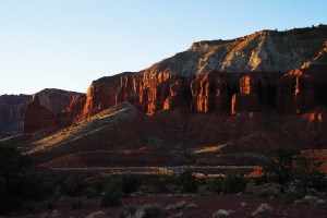
 We definitely saved the best for last! After spending the evening back at camp, Eddie & I drove back up to Panorama Point for some sunset photos. Spectacular as that was, it was the International Dark Sky that we were really there for. (Check out some important info on the Dark Sky HERE). We set up our tripods and readied ourselves for trying our hands at some astrophotography. It was a valiant first effort, but more than that we had to just sit back and stare at the sky. There were so many stars – and layers of stars
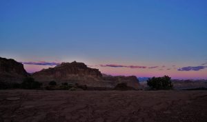 – in the dark purple and indigo skies, that it created a 3-D type effect.
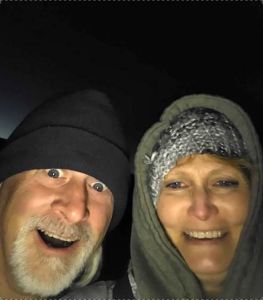 We’d never seen anything like this! Cold as it was in April in the wee hours, it was an experience we’ll never forget. We turned in about 2:30 am, cold, tired, a little hungry, but oh… so… content.
INTERESTING INFO:
*Capitol Reef National Park gets it’s name from: the white domes resembling the dome on the U.S. capitol bldg (CAPITOL) & the Waterpocket Fold that looks like a coral reef (REEF).
*Annual visitation to the park exceeds 1 million annually.
*After 1,000 yrs of occupation by the Fremont people, Mormon pioneers came into the area. At the Pioneer Register you can see where they, too, carved their names into the sandstone rock. Check out that info HERE.
 *Two business men from the early 1900s, organized a booster club to begin promoting the beautiful landscape around Torrey, Utah. In 1924, they hired a photographer from Salt Lake City, who came to the region and photographed what is now Capitol Reef. At the time, they called the area “Wayne’s Wonderland,” and using the photos, they began promoting the region and its natural beauty across the country. They were Ephraim Portman Pectol and his brother-in-law (and Utah Legislative Senator) Joseph S. Hickman (thus the Hickman Bridge).
*More than 220 Species of Birds live in capitol Reef.
*Capitol Reef qualifyed as an International Dark Sky Park in 2015. This means that measures have been taken to reduce light pollution and programs have been provided to inspire star gazing.
*The Fruita Orchards, first planed by Mormon pioneers, are now open to the public. During the harvest season, you can pick and eat your favorite treats. For a small fee you can even bag some up and take them home with you.
*At Capitol Reef, you can take a tour on horseback or trek with a llama. Click HERE for more info.
GOOD TO KNOW BEFORE YOU GO:
*We stayed at Wonderland RV Park just a few miles outside the western entrance to the park. The owners here also keep the cattle that are kept next to the property. This was one of our favorite RV parks. It had clean restrooms and lots to see on the place. I give this one a 9 out of 10. Check out the website HERE.
*If you’re planning on doing some star gazing or astrophotography – which you sure should – bear in mind that there is a wait between sunset and dark sky. It can also get cold. Bring water, snacks, and chairs. Also, don’t wait and come in really late. Your headlights will ruin it for photographers.
 *The desert is an extreme enviornment, so make sure to carry enough water if you hike. Unless its monsoon season…then just get out of the rain. Always check weather conditions before venturing out. Check HERE for flash flood info.
*For info and a park map to plan your visit, click HERE.
***********************************************************************
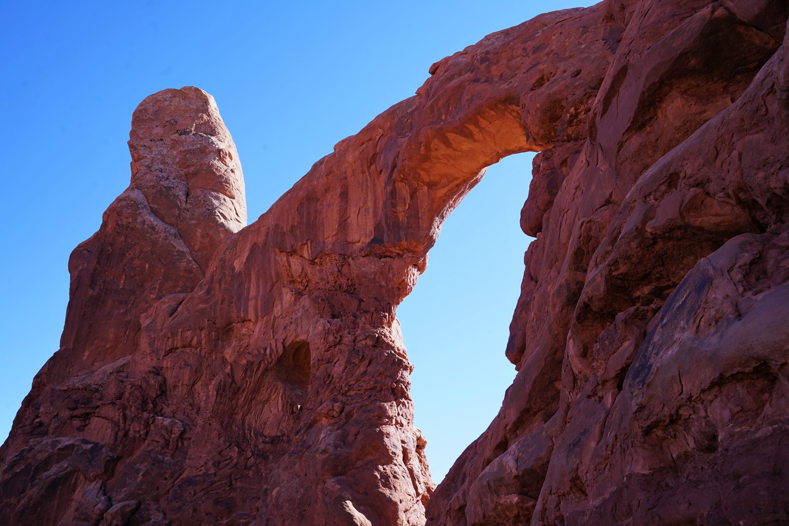
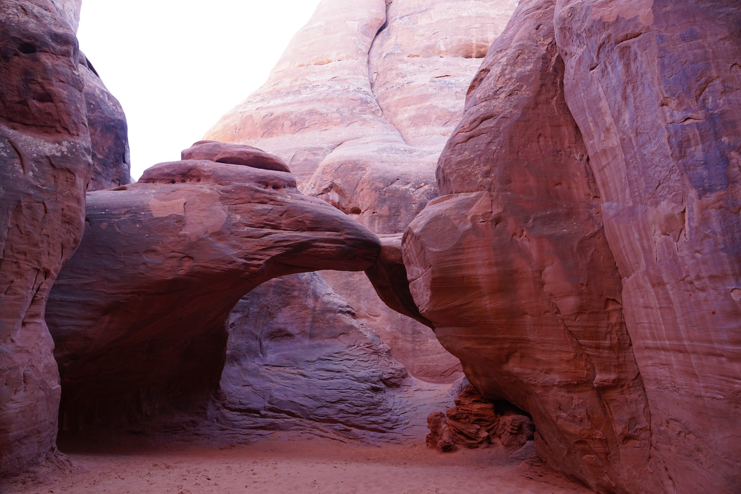
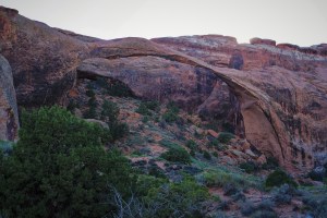
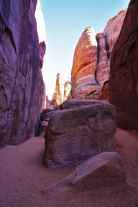
Stop #6: Arches National Park, UT
In 1929 President Herbert Hoover created Arches National Monument, then in 1971 Congress designated Arches as a National Park under President Richard Nixon.
 Arches National Park is in east central Utah, just minutes from Moab.
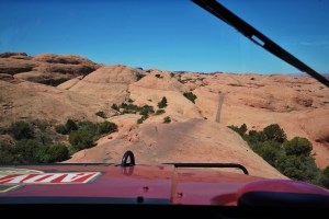
We started our day in Moab with a Hummer tour up Hell’s Revenge near Slickrock. If you’ve never done something like this before, its a ride you’ll never forget! I highly recommend this excursion as a fun addition to your time in Moab. Not for the faint of heart, though. Click HERE for some more info.
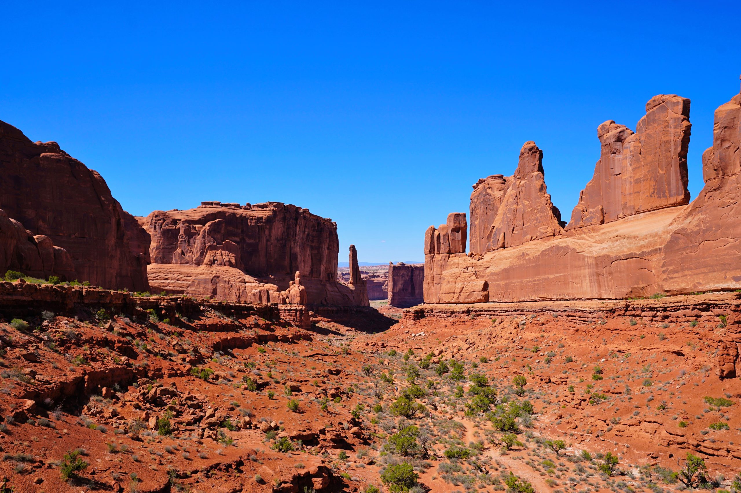
After our stomachs returned to their normal positions, we grabbed some lunch and then headed into the Park. Arches is an aptly named National Park, and we saw as many of those arches as we could. We started at the visitor’s center, explored Park Avenue, the Courthouse Towers, the Petrified Dunes, the ‘Windows’ section, the Fiery Furnace, hiked the Devil’s Garden trail to Landscape Arch, and ended our day with sunset pictures at Delicate Arch. Whew! It was a beautiful day. There are many hikes in the park, and my favorites were the ones into the slot canyons. The pinks, oranges and purples of the canyon’s walls and floors were colors I’d never seen in sand. It was raining by the time we arrived back at camp, so we were happy to had such pretty blue skies during our day at the park!


INTERESTING INFO:
*There are more that 2000 natural sandstone arches inside the park.
*Landscape Arch has that longest span of any arch in North America, and is the 4th largest in the world. It’s a beautiful hike to get there (only about 2 1/2 miles round trip), and there is some interesting info at the arch about how it came to be.
 *Over 1.5 million people visit the park each year.
*Over 11 films have been made at Arches National Park, including Indiana Jones and the Last Crusade, and Thelma & Louise.
*The park comprises about 119 square miles.
GOOD TO KNOW BEFORE YOU GO:
*We stayed at Canyonlands RV. The camp was clean with decent bathrooms and showers. It was a tight squeeze, though, and because there’s no walking path to the restrooms, people kept cutting through our site. There is a great little store/gas station there that provided us with some pretty great ice cream! I’d give this RV park a 6 out of 10. Find there website HERE.
 *Even if you are not into hiking, stop and see one of the slot canyons. Sand Dune arch is about a 5-7 min walk from the car, and it is beautiful!
*There is low light pollution here, so its great for night photography or stargazing.
*There’s lots to see in Moab, so get out and walk the town! We loved the ice cream at the Moab Diner.
*For info and a park map to plan your visit, click HERE.
*Edward Abbey, a monument employee in the 1960’s, is probably the most famous person associated with Arches. His diary, Desert Solitaire, depicts stories of The Monument and attracted generations to Arches National Park.
***********************************************************************
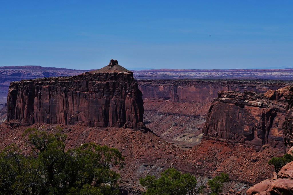
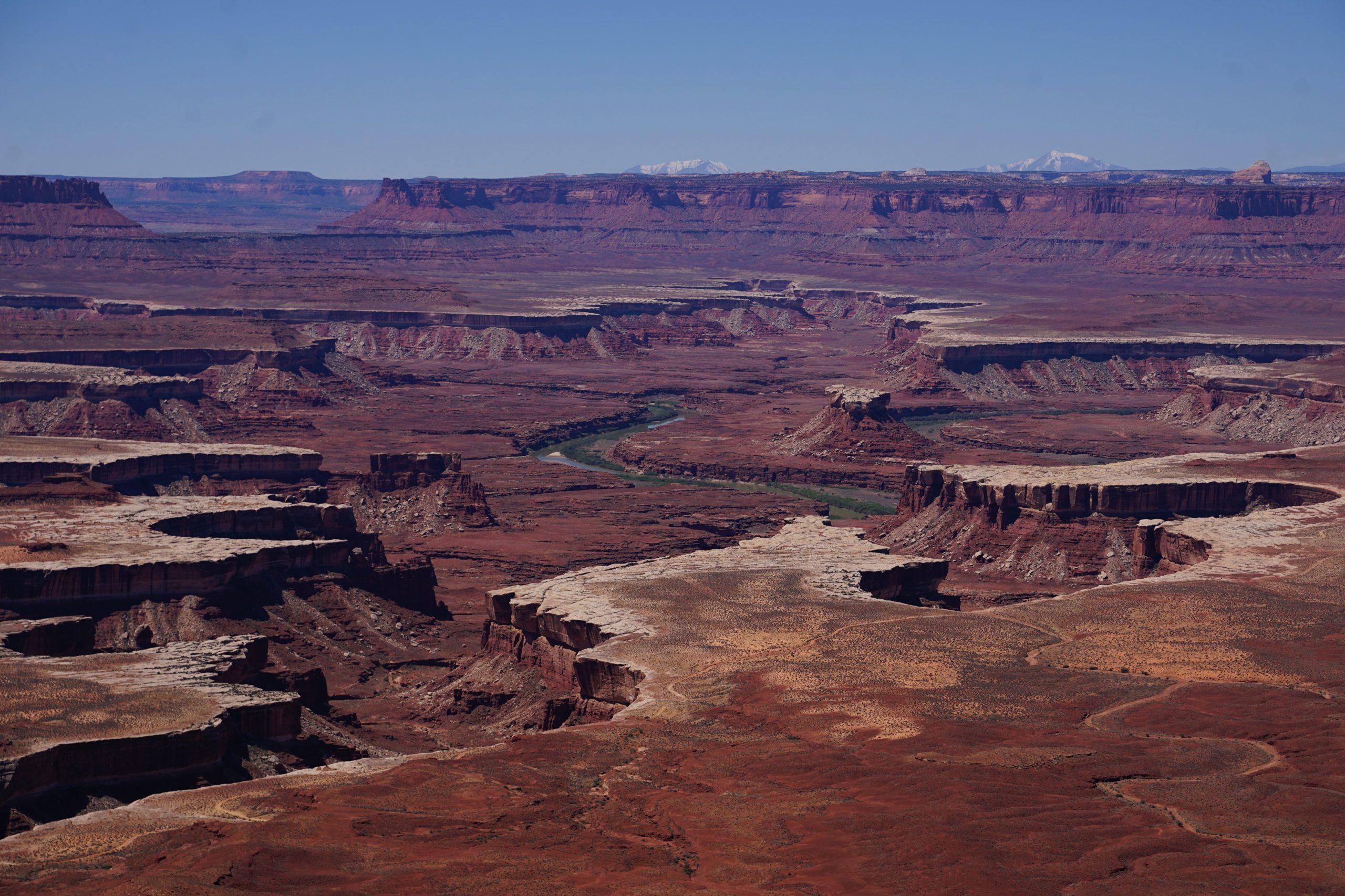
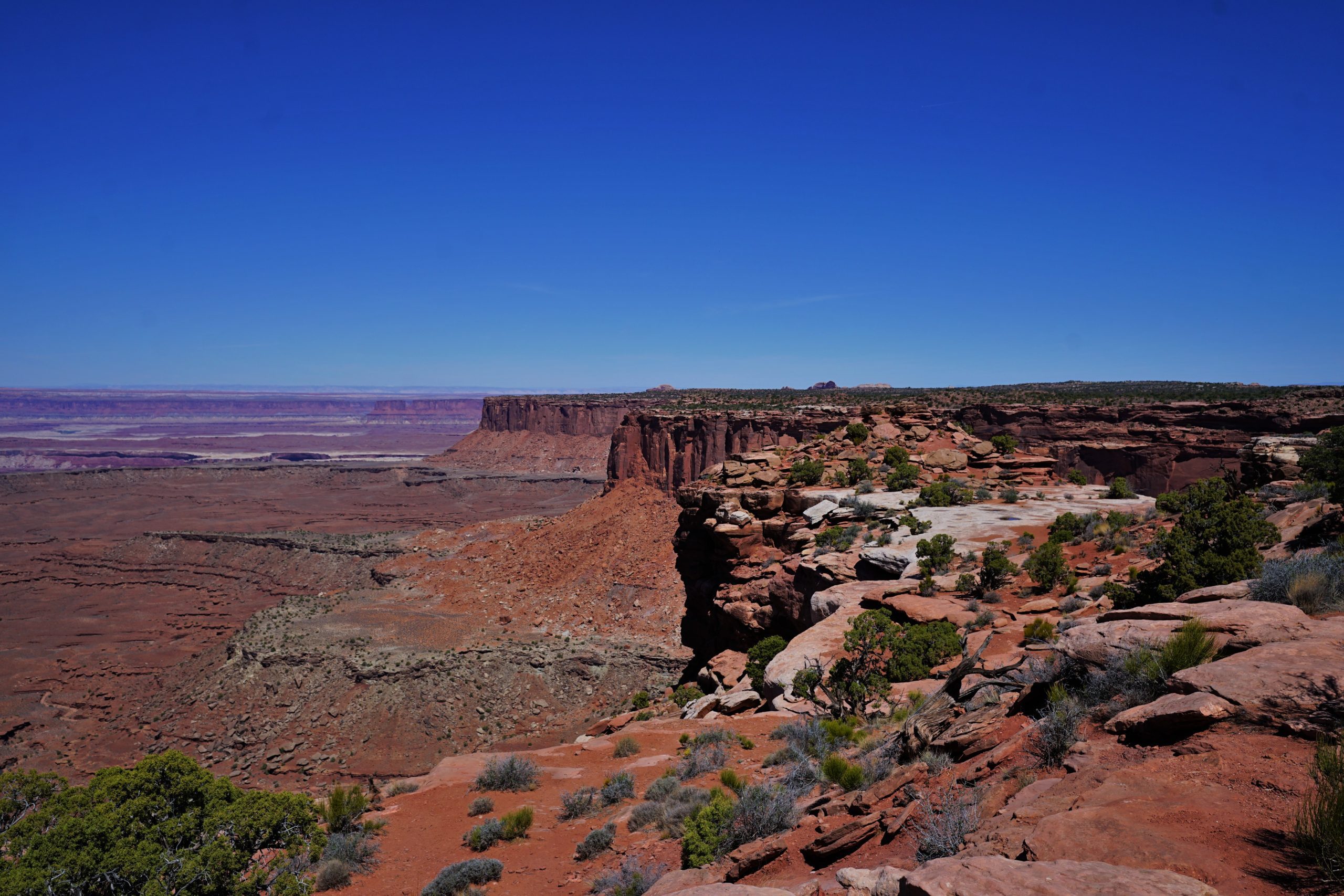
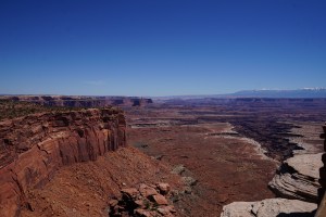
Stop #7: Canyonlands National Park, UT
After many jeep tours in the 50’s & 60’s, and long discussions by campfire, Arches National Monument superintendent Bates Wilson finally convinced (the then Secretary of the Interior) Stewart Udall to advocate for Canyonlands at the national level. Canyonlands National Park was officially established in 1964 by President Lyndon B. Johnson.
Canyonlands National Park is located in east central Utah just 26 miles from Arches National Park.
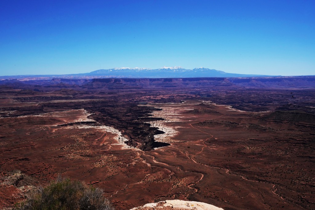
The plan had been to get up early and drive into the park, hike to the Mesa Arch for sunrise photos, and enjoy a tailgate breakfast. It was a great plan. So…we slept in until 9. Canyonlands was the last national park for this trip, and because we’d been dealing with the rain, snow, and wind the entire trip, we were a little weary. As beautiful as all this weather was, it was a challenge to be camping in. On this day, it was sunny and warm, and the skies were sapphire blue. It was the first time we could enjoy some time at camp outside, so we just relaxed and enjoyed brunch. Sunrise photos would have to wait until next time around.
For us, this delightful park was a one-and-done, and was easily done in a day – if – you pick either the north side or the south side. The north side of the park is serviced by the Island in the Sky Visitor’s Center, and will treat you the Shafer Trail Overlook, the Mesa Arch, Buck Canyon, White Rim, Orange Cliffs and the Grandview Overlook. On the south side of the park, you’ll find the Needles Visitor Center along with the Wooden Shoe Overlook, the Big Spring Canyon, and the Confluence Overlook. Both areas are breathtaking, but we felt like there was a little more to see on the south side.
If you want to see both sections of the park on a day, it is doable, but you won’t have much time to take advantage of the many scenic hiking trails.


INTERESTING INFO:
*Cathedral Point, on the south side in the Needles District, stands at 7,120′.
*The first people visiting the park about 10,000 yrs ago left behind rock art, which can be seen in the Needles District.
*Ancestral Puebloans, who lived in the park about 2,000 yrs ago, left behind graneries and dwellings that can also be seen in the Needles District.
 *Butch Cassidy and the Wild Bunch gang had their Robber’s Roost hideout in the Maze District located on the north side.
*Most of the rock in Canyonlands today was formed by the breaking down of ancestral mountain ranges. Upheaval Dome (located on the north side), however, has geologists stumped. Is it the remains of a salt dome, or was it created by a meteorite impact? Take a look for yourself and see what you think!
*About 400,000 people visit the park each year.
GOOD TO KNOW BEFORE YOU GO:
*We stayed a 2nd night at Canyonlands RV. The camp was clean with decent bathrooms and showers. It was a tight squeeze, though, and we felt right on top of our neighbors on both sides. And because there’s no walking path to the restrooms, people kept cutting through our site. There is a great little store/gas station there that provided us with some pretty great ice cream! I’d give this RV park a 6 out of 10. Find there website HERE.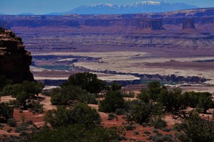
*Canyonlands National Park is separated by the Colorado and Green Rivers. You can see where they come together at the Confluence Overlook on the north side. The rivers separate the park into 3 Districts: The Island in the Sky and the Maze Districts in the north, and the Needles District in the south. The Convergence of the 2 rivers in the north is often considered a 4th District.
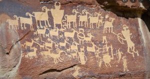 *There is a standalone unit northwest of Island in the Sky called Horseshoe Canyon. From the parking lot its a mere 7 mile rd-trip (strenuous) hike to see the Great Gallery, one of the country’s best panels of ancient rock art.
*It is 107 miles (2 hrs drivetime) to get from one visitor’s center to the other.
*The Island in the Sky Visitor’s Center is 32 miles from Moab, and the Needles Visitor’s Center is 74 miles from Moab.
*For info and a park map to plan your visit, click HERE.
That concluded our ‘7 Parks in 9 Days’ trip to the American SW. We came back with lots of photos, memories and plans for our return trip.
I guess the biggest question was, ‘what took us so long?!!’
Your 9 day trip looks like it was amazing. Fantastic photos too!! We went to Arches a couple of years ago. Our favorite part was Fiery Furnace. Because it was so hot (we went in August) we adventured the lower half in the morning and the upper in the evening. Now that we live in Tucson we have many more adventures on our checklist that you covered in this post. Fun times!
You moved to Tucson? How do you like it there? I’m sad because I was hoping to eventually see you again…